 Lung Cu and its famous Flag Tower - Ha Giang Province
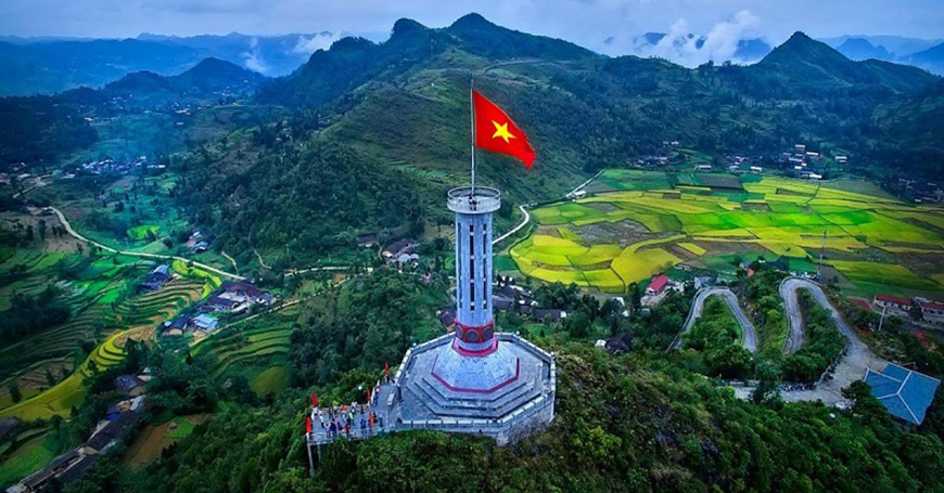
Lung Cu and its Flag Tower, located in the northernmost part of Vietnam, represent an emblematic site combining strong national symbolism with rich cultural heritage and unique tourist attractions.
Geographic location
Lung Cu is situated in
Ha Giang province, approximately 430 km from Hanoi, and culminates at an altitude of 1,700 meters on Long Son Mountain (Dragon Mountain). This site marks the symbolic northernmost point of Vietnam,
near the Chinese border. The landscapes there are characterized by majestic mountains, deep valleys, terraced rice fields, and two small twin lakes that never dry up, located below the flag hill.
History and symbols
The origins of the Lung Cu Flag Tower date back to the 11th century, under the Lý Dynasty, when commander-in-chief Lý Thường Kiệt erected a national flagpole to defend the territory and mark the northern border of Đại Việt. In the 18th century, after the victory against the Qing invaders, King Quang Trung had a large bronze drum installed, which was struck every two hours to affirm territorial sovereignty. The current tower, rebuilt and restored several times, notably in 2010, is an octagonal structure 33 meters high. It flies a giant Vietnamese flag of 54 m², symbolizing the 54 ethnic groups of the country. The pedestal is decorated with motifs inspired by Đông Sơn bronze drums, embodying Vietnamese history and culture. Thus, the flag and the tower symbolize not only sovereignty and patriotism but also the unity and ethnic diversity of Vietnam.
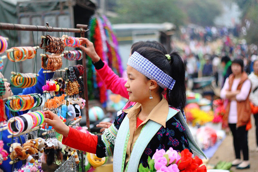
 Ethnic communities at Local Markets in Ha Giang
 Ethnic groups and local culture
The population of Lung Cu is predominantly H'mong (over 90%), with also Lô Lô (notably in Lô Lô Chải village), Dao, and other groups. The inhabitants live from terraced agriculture, traditional weaving, and rural tourism. Lô Lô Chải village is an example where inhabitants preserve their culture through their ancestral habitats, costumes, and way of life.
Must-see tourist attractions
- Lung Cu Flag Tower: An ascent of 286 to 389 steps leads to the tower (a motorbike parking lot can reduce the climb), offering a spectacular panorama of the mountains, villages, rice fields, and even extending into China. The entrance fee is approximately 25,000 VND.
- Lô Lô Chải Village: Just at the foot of the tower, an unmissable stop to discover the Lô Lô ethnic culture, with the possibility of staying in an authentic homestay.
- Local Market: Immerse yourself in the atmosphere of local culture at the weekly market of Quyet Tien (on Saturday mornings).
- Dong Van Karst Plateau: A UNESCO World Heritage site, it is a geological and cultural paradise with motorbike rides, hikes, and village exploration.
 Terrace Rice Paddies of Lung Cu
 When and how to get there?
Best period and access
The best time to visit is from October to November (clear and temperate weather, buckwheat blooming) and spring (February to April, peach and plum blossoms). It is advisable to avoid July-August (rain and slippery roads) and winter (December-January, cold and fog).
To get there from Hanoi, an overnight bus goes to Ha Giang (7 to 9 hours). From Ha Giang, it is possible to rent a motorbike, take a taxi or a car to travel the 150 km to Lung Cu via Dong Van. The last 20 km stretch between Dong Van and Lung Cu is winding but passable. Local "Easy Rider" guides are an excellent option for those who do not drive.
Lung Cu is much more than a point on the map: it is a living testament to a multicultural, tenacious, and proud Vietnam, with striking natural beauty.