Updated:january 2025
The Ha Giang Loop has experienced a significant surge in popularity in recent years, establishing itself as one of the most celebrated travel itineraries in Northern Vietnam, and potentially within the country as a whole.
Mountain pass of Ma Pi Leng in Ha Giang Province - Photo : Mr Linh's Adventures
The loop is located in the province of
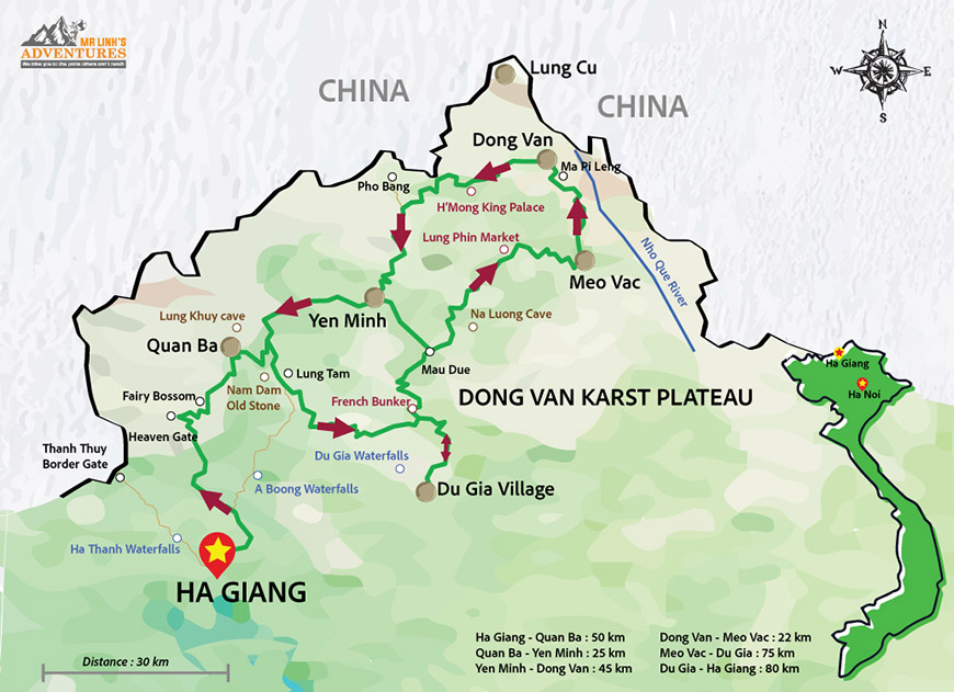
Ha Giang, and travellers set out from Ha Giang Town, heading either north towards Quan Ba or east towards Bac Me. As you have to purchase a travel permit in Ha Giang Town, you are required to start from here, but once this is done you could take any route you fancy, though most travellers follow the route described in this article, which is the one most commonly known as “The Loop”. For your convenience we have prepared a map of the loop with the most impressive attractions along the way below:
 Map of Ha Giang Province
Before we get to the route itself, it’s worth talking about precisely HOW to do the loop. Depending on how adventurous you are, there are a few options. The easiest and most comfortable will be to book a guided tour of the province (we suggest at least 3-5 days), which will allow you to not worry about any of the details and simply sit back and enjoy the amazing scenery.
The second option is to take a bus from Hanoi (leaving twice a day), and rent a motorcycle in Ha Giang Town on arrival. There are plenty of rental places in town, as this has become a common way to travel, and you should have no trouble finding a good place to rent one here.
Quan Ba, the Heaven Gate - Photo Mr Linh's Adventures
Travellers who feel brave enough to tackle Hanoi traffic or those who wish to go on a broader motorcycling trip through Vietnam should consider renting their motorcycle in Hanoi itself. This often leads to a lower price, as well as allowing you to take the motorcycle with you throughout Vietnam, perhaps even handing it back at a different location. For even more unrestricted freedom, you can purchase a motorcycle outright, either from a dealership or a fellow traveller.
An important consideration is the recent intensification of roadside checks. Travelers opting for motorcycle travel must ensure they have the necessary permits. Alternatively, the serenity of a guided tour may be a preferable option.
In terms of timing and weather, the most pleasant conditions in Ha Giang can be experienced either in the spring months of March to May, when the rice fields are verdant green, or the autumn months of September to October, when the fields instead change to a deep golden hue.
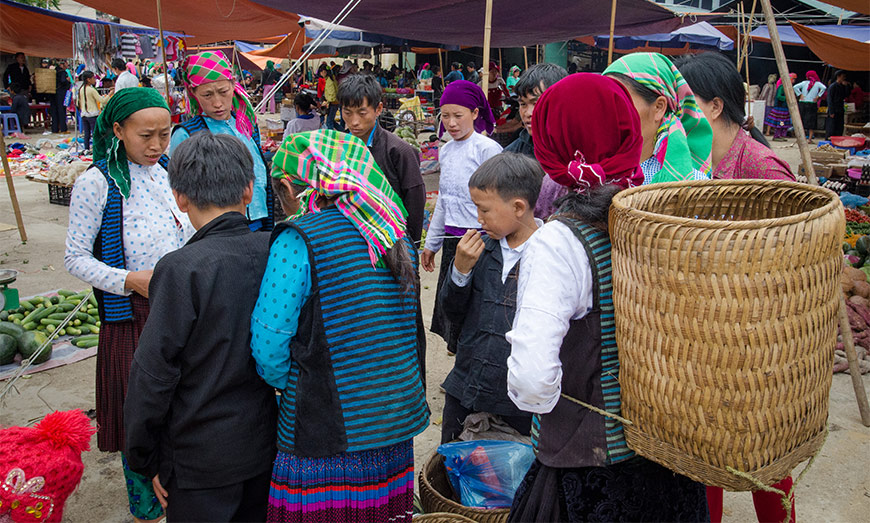
 Local market place In Ha Giang
Regardless of how you choose to do it, the general route will most likely be the same, and we suggest planning 5 days in the province, or at least 3 for those who are short on time. Setting out north from Ha Giang Town you will eventually reach
Quang Ba Pass, known as “
Heaven’s Gate” and acting as the gateway to
Dong Van Plateau.
Dong Van Geopark - Photo : Mr Linh's Adventures
Once on the plateau you will reach
H’mong King’s Palace containing some fascinating history as well as an amazing nearby viewpoint. Next you can take an optional detour of the loop itself to visit
Lung Cu Flag Tower, the country’s northernmost point.
After that you head south, stopping in
Dong Van old quarter if you wish to see the oldest buildings in the province as well as a great local market, before reaching
Ma Pi Leng Pass, considered by many to the most spectacular natural scenery of the country. Here the road is carved directly into the cliffside as you wind your way into
Meo Vac valley, a charming and authentic district filled with local ethnic minorities.
On the way to Meo Vac - Photo : Mr Linh's Adventures
After enjoying Meo Vac, you will continue south and west through Yen Minh and Bac Me, eventually arriving back in Ha Giang Town after your 360km round trip. While this last section is skipped by many in favour of heading west from Meo Vac along DT182 until you reach QL4C again, at which point you’re just retracing your steps back to Ha Giang Town. This alternative route is the shortest option and might be worthwhile if you are short on time.
Any questions? Need advice?
Just contact us! We'll be delighted to help.